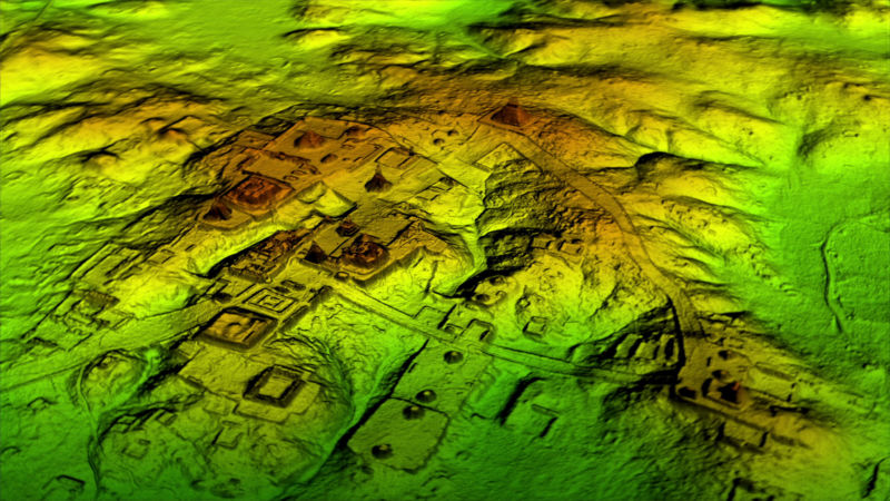
An airborne lidar survey recently revealed hundreds of long-lost Maya and Olmec ceremonial sites in southern Mexico. The 32,800-square-mile area was surveyed by the Mexican Instituto Nacional de Estadistica y Geografia, which made the data public. When University of Arizona archaeologist Takeshi Inomata and his colleagues examined the area, which spans the Olmec heartland along the Bay of Campeche and the western Maya Lowlands just north of the Guatemalan border, they identified the outlines of 478 ceremonial sites that had been mostly hidden beneath vegetation or were simply too large to recognize from the ground.
“It was unthinkable to study an area this large until a few years ago,” said Inomata. “Publicly available lidar is transforming archaeology.”
Over the last several years, lidar surveys have revealed tens of thousands of irrigation channels, causeways, and fortresses across Maya territory, which now spans the borders of Mexico, Guatemala, and Belize. Infrared beams can penetrate dense foliage to measure the height of the ground, which often reveals features like long-abandoned canals or plazas. The results have shown that Maya civilization was more extensive, and more densely populated, than we previously realized.
The recent survey of southern Mexico suggests that the Maya civilization may have inherited some of its cultural ideas from the earlier Olmecs, who thrived along the coastal plans of southern Mexico from around 1500 BCE to around 400 BCE.
Cosmological construction
The oldest known Maya monument is also the largest; 3,000 years ago, people built a 1.4 kilometer-long earthen platform at the heart of a ceremonial center called Aguada Fenix, near what is now Mexico’s border with Guatemala. And the 478 newly rediscovered sites that dot the surrounding region share the same basic features and layout as Aguada Fenix, just on a smaller scale. They’re built around rectangular plazas, lined with rows of earthen platforms, where large groups of people would once have gathered for rituals.
Inomata and his colleagues say the sites were probably built in the centuries between 1100 BCE (around the same time as Aguada Fenix) and 400 BCE. Their construction was likely the work of diverse groups of people who shared some common cultural ideas, like how to build a ceremonial center and the importance of certain dates. At most of the sites, where the terrain allowed, those platform-lined gathering spaces are aligned to point at the spot on the horizon where the Sun rises on certain days of the year.
“This means they were representing cosmological ideas through these ceremonial spaces,” said Inomata. “In this space, people gathered according to this ceremonial calendar.” The dates vary, but they all seem linked to May 10, the date when the sun passes directly overhead, marking the start of the rainy season and the time for planting maize. Many of the 478 ceremonial sites point to sunrise on dates exactly 40, 80, or 100 days before that date.
City plans built around calendars or cosmology were key features of several Mesoamerican civilizations, including both the Maya and the Olmec.

